Route 2: Garadhban, lower woods
- Distance: 6.5 km/5 km (4 miles/3 miles)
- Location: 2.5 km north of Drymen on the single track Old Drymen to Gartmore Road (National Cycle Route 7)
- Parking: About two horse boxes/trailers
From the signed Forestry Commission Scotland car park cross the road and follow the track into the forest, green way-markers initially marking the route. As you descend there is an occasional glimpse of the Loch Lomond Hills through the thin mature Sitka spruce. The track here is fairly good going with some stony parts. After about 800 metres the views open up to the west with fabulous vistas of Loch Lomond and the surrounding hills to your right and the Kilpatrick Hills to the south.
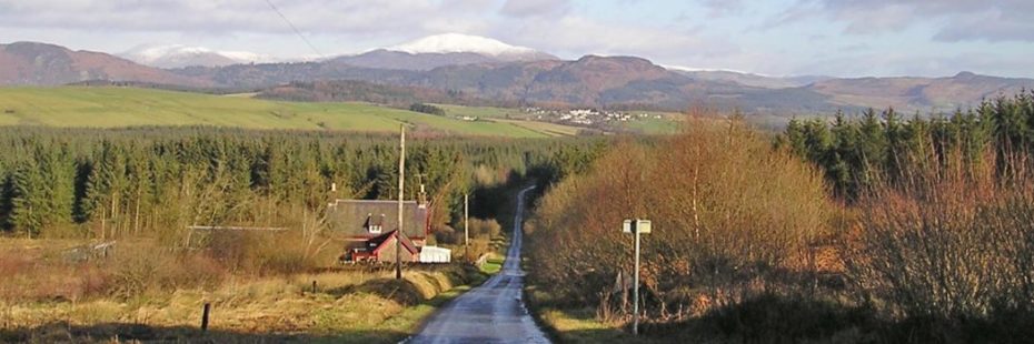
Old Drymen road looking towards Aberfoyle
Look out for buzzards and kestrels hunting over the open ground. Continue down the track and where it re-enters the trees you will see the hill of Dumgoyne framed in front of you. About one kilometre down the route the West Highland Way joins you from the right. Continue on your track to a T-junction with lovely views of the Campsie Fells. Turn left here, it is very stony for a short while until you re-enter the forestry taking the next left fork.
This is a good uphill track for cantering. Continue on, with a route coming in from your left about half way. At the end of this canter track turn left onto a narrow, informal path through trees. After about 100 metres turn left again onto a single track down a ‘forest ride’ (open corridor between blocks of trees). After about 200 metres take the wider track to your left and continue along this until you reach the canter track, turn right and return to the car park. Alternatively continue down the forest ride and rejoin the main track by turning right through wooden barriers opposite the West Highland Way. The last few metres of this track are a bit rough and wet, and the ground can get soft and
churned up if over-used.