Route 7: Milton rides, Loch Ard
- Distance: 12.75 km (8 miles)
- Location: 2.5 km west of Aberfoyle
- Parking: About four horse boxes/trailers
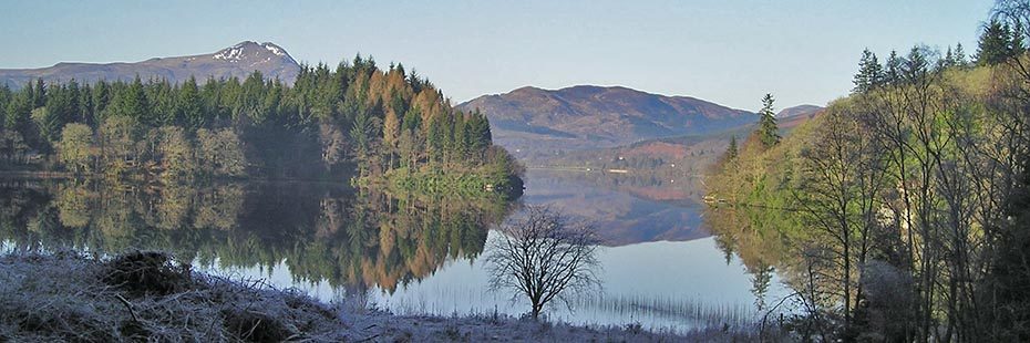
Loch Ard with Ben Lomond in the distance
This ride starts from Milton car park described in Routes 5 & 6 and combines two of the Forestry Commission Scotland waymarked routes along Loch Ard. It follows well compacted forest roads and paths which may have some loose material in places. It leads you along the water’s edge through native woodland and mature conifer and offers fantastic views of Loch Ard, Ben Lomond and the surrounding hills. Look out for wildlife sculptures around this route.
From the car park, go back along the forest road following the red waymarked route towards the shores of Little Loch Ard. You will need to step over a low-rise horse friendly gate. Continue along the shore, ignoring the yellow marked route to your left. Just after reaching Loch Ard, red waymarkers take you to the right to Rob Roy’s cave; you should ignore this turn and continue straight on, as it is not suitable for horses. Here the views open up with fantastic glimpses of Ben Lomond. A little further on, the red route turns off to the left (also marked with letter ‘f’), but ignore this and continue straight on. You soon come to a junction, letter ‘i’, with both directions showing green waymarkers. Ignore the route up to the left and continue straight on along the path nearest the loch shore.
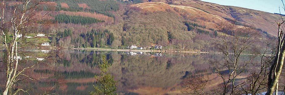
Loch Ard
Follow the green waymarked route to the right, which loops around the shore on a good grassy track. A short climb gives a great view of Loch Ard, with Forest Hills Resort on the opposite shore. Around the corner you also glimpse a small island called Eilean Gorm, which is Gaelic for Green Isle, and the remains of a crannog, a type of ancient loch dwelling. Continue following the waymarkers, passing beside a barrier and over a small bridge. After the bridge, look to the right to see a section of the 40 km long aqueduct which carries water from nearby Loch Katrine to the people of Glasgow.
Continue to follow the waymarkers uphill, turning left at the letter ‘o’ onto a forest road with fantastic views down onto Loch Ard. The surface of this road can be quite stony in paces. The green waymarked route turns left down a narrow track at letter ‘p’, ignore this and continue straight on. After about 1 km you will rejoin the red waymarked route. Ignore the route dropping downhill to the left at letter ‘g’ and continue on the road past a picturesque lochan, Lochan a’ Ghleannain or ‘small loch of the small glen’. After another 1km you pass through a barrier and the horse box parking is on your right.