Three Glens Route
Grading: hard.
An awesome loop with an adventurous mountain crossing. The route features three beautiful glens and a big climb into the upper reaches of Glen Kendrum, followed by a sweeping descent of Gleann Dubh into Glen Dochart. This is wild mountain biking at its best.
At a glance
- Description: clockwise
- Distance: 21 km /13 miles
- Ascent: 500m
- Type: mountain bike circuit
- Signage: partial signing with National Cycle Network 7 (NCN7)
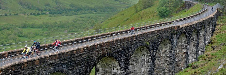
Glen Ogle viaduct
Route description
From the car park at the top of Glen Ogle (OS Grid Ref. NN558 284), follow route NCN7 south for an easy downhill cruise through the stunning Glen Ogle with its spectacular viaduct, crags and forests. After 6.2km the track splits at Craggan – follow the Right branch, pass 3 metal gates until a small rail bridge. Take the Right turn immediately after the bridge, and head into Glen Kendrum.
The next 5km involves a big climb into the atmospheric upper sanctum and although never really steep or technical it’s tough going – keep spinning and enjoy the stunning scenery.
After passing under the dark and brooding crags of Creag Mac Rànaich (809m), the track enters a high summit col – a great place to refuel and psych-up for the descent. Buckle-up as the track now takes a fast and sinuous route for 4.6km down the valley, pick your line and watch out for the occasional stray boulder or rough section. After a picturesque river crossing, continue downhill to the derelict train bridge. Turn Right on the restored track and after 1km a Right fork – follow this track for 4km back to Lochan Lairig Cheilè and the car park.
Points of interest
- Glen Ogle viaduct
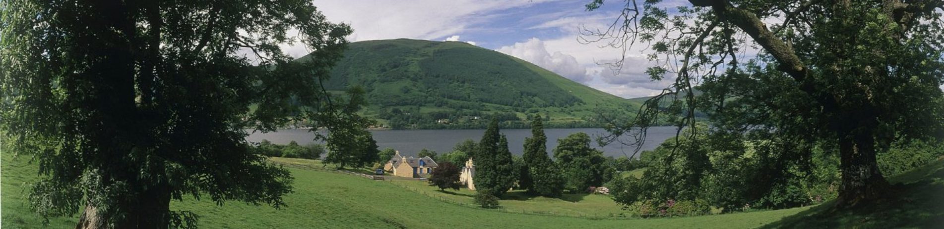
- Loch Earn
- Glen Ogle, Glen Kendrum, Glen Dochart and Gleann Dubh
Facilities
Refreshments and accommodation are available in Crianlarich, Killin and Lochearnhead.
Download route card
Details are current as of October 2015. Whilst the Loch Lomond & The Trossachs National Park Authority and its project partners have made every effort to ensure the accuracy of the route card information, Loch Lomond & The Trossachs National Park Authority and its project partners cannot be held responsible in any way for any changes that may take place to the routes, nor for any errors in the route cards, nor for any accidents, injuries or damage sustained whilst following the routes. Cycling is a risk sport and all persons using the cycle routes do so at their own risk, acknowledging and accepting the risk of accident, injury or damage.