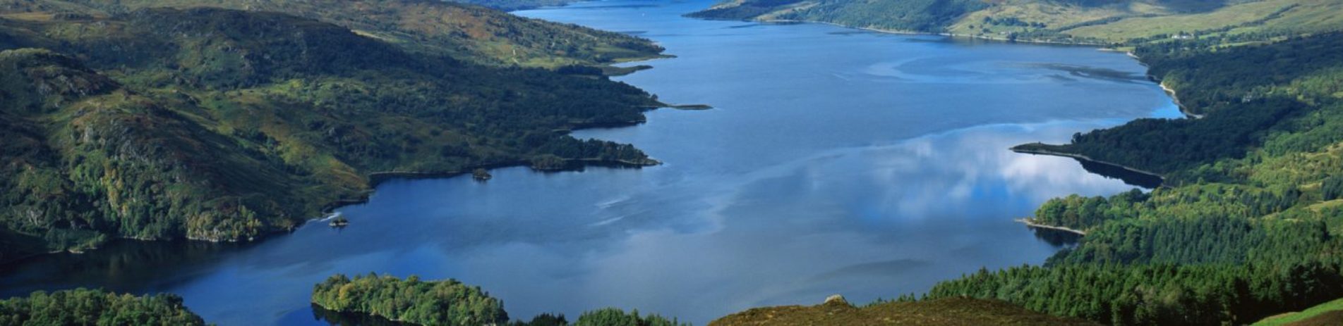
Lochs in the National Park
From breathtaking mountains and glens, to the vast tranquil beauty of our lochs, our National Park boasts some of the most stunning scenery in the world.
Whatever you’re looking for, you’ll be spoilt for choice here. So to make it a bit easier for you here’s our helpful guide to some of the most beautiful places to visit, centred on our lochs.
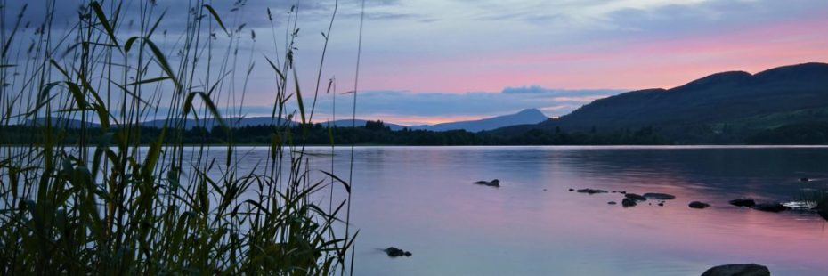
Loch Chon
Loch Chon (credit: John McSporran)
Surrounded by forestry and with wonderful views of nearby hills and mountains, Loch Chon is a gem of a discovery for outdoors fans. It’s fabled that the sheltered water, located between Kinlochard and Inversnaid on the minor B829 road, has a resident kelpie (water spirit), as well as one of the world’s largest populations of faeries!
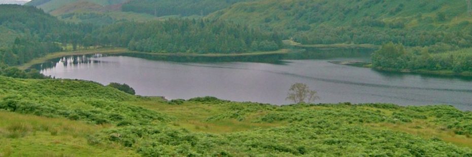
Loch Ard
Loch Ard
Located in the Great Forest of Loch Ard and close to the town of Aberfoyle, Loch Ard is a picturesque area of freshwater measuring some 2.5 miles by one mile. The loch is said to be the source of the River Forth, which continues its journey to the sea at the Firth of Forth on the east coast.
Three Lochs Forest Drive
Loch Achray
Get off the beaten track in your own car on a forest drive that combines history with fabulous scenery and wildlife in the heart of the Queen Elizabeth Forest Park.
The seven-mile (11.5km) one-way Three Lochs Forest Drive begins about two miles north of the popular town of Aberfoyle on the A821, The Duke’s Pass. It was launched 40 years ago in 1977 to celebrate the Silver Jubilee of Queen Elizabeth II.
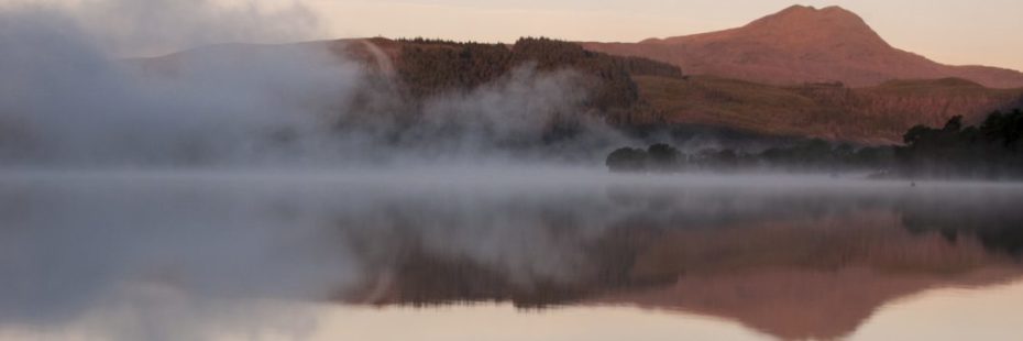
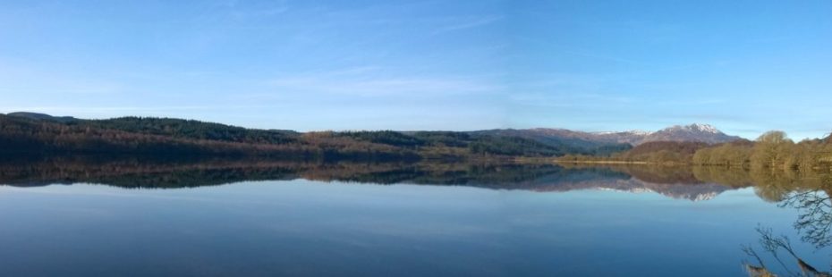
Lake of Menteith
Lake of Menteith at dusk
Famous as being Scotland’s only lake, rather than loch, the Lake of Menteith is discovered in the Carse of Stirling, close to the city. Strangely, and for no known reason, the small lake was called the Loch of Mentieth until the 19th century.
Loch Arklet
Loch Arklet (credit: John McSporran)
A remote loch, Arklet is well worth the effort to reach thanks to its fabulous location. From the town of Aberfoyle, you take the B829 Inversnaid road, passing first Loch Ard, then Loch Chon before finally coming across Loch Arklet. It is actually a neighbour, to the east, of far larger Loch Lomond and lies west of Loch Katrine.
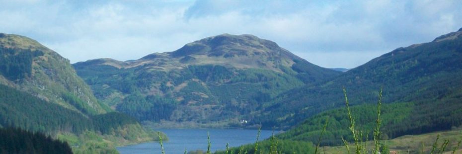
Loch Earn
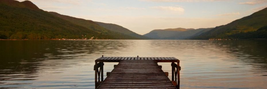
Loch Earn at St Fillans
Loch Earn is a long, narrow stretch of water located at the eastern side of the National Park. Extending 6.5 miles from west to east, the loch is the source of the River Earn, which eventually winds its way to join the River Tay, Scotland’s longest river, in the Perthshire village of Bridge of Earn.
Loch Eck
Loch Eck
The narrow seven-mile long stretch of Loch Eck is located on the Cowal peninsula, north of the town of Dunoon, and within the beautiful Argyll Forest Park, itself part of the Loch Lomond and The Trossachs National Park.
Loch Goil
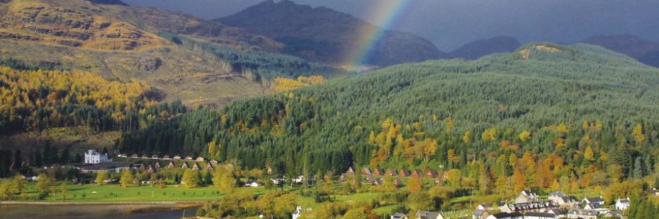
Rainbow over Loch Goil
A small sea loch on the western edge of the National Park, Loch Goil forms an arm of Loch Long and a coastal section of the Cowal Peninsula.
Holy Loch
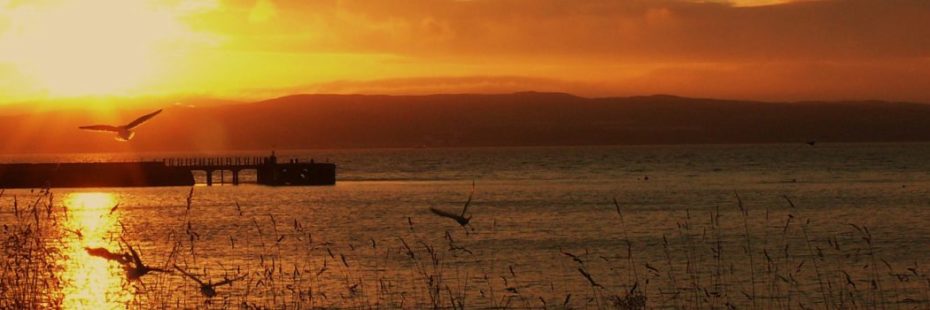
Sunrise over Holy Loch
Located to the south-western edge of the National Park is the Holy Loch. The National Park edges the northern shore of the sea loch, which measures one mile wide by up to three miles long, depending on the tide.
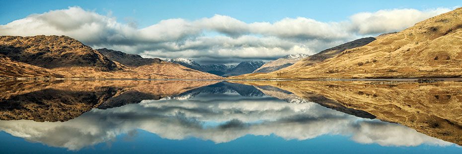
Loch Katrine
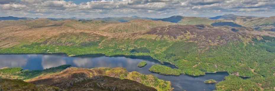
Loch Katrine from Ben Venue
Loch Katrine was the inspiration for the famous 19th century poem, The Lady of the Lake, by Sir Walter Scott, and still beguiles visitors some two centuries later. It was here, too, on this eight-mile long loch at the heart of the National Park, that Queen Victoria enjoyed a boat trip in 1869.
Loch Long
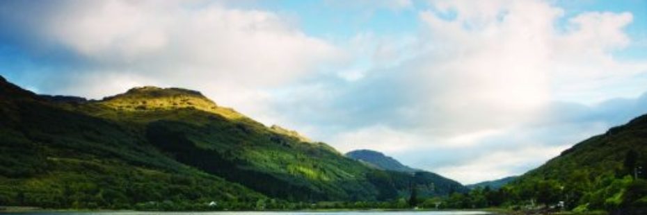
Loch Long
Loch Long, in the west of the National Park, forms a sea loch extending 20 miles from the Firth of Clyde at its southwestern end. Similar to a fjord, the loch forms a long indent with the coast of the Cowal Peninsula on one side and the entire western coastline of the Rosneath Peninsula on the other side.
Loch Lomond
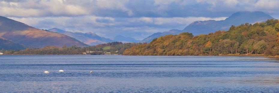
Loch Lomond (credit: Vlad Turculet)
The largest inland stretch of water in Britain, Loch Lomond is one of the most popular destinations in Scotland. The loch, which famously features in the song ‘The Bonnie Banks o’ Loch Lomond’, extends north for 24 miles from Balloch, which is a popular access point to the the Highlands.
Loch Lubnaig
Loch Lubnaig
Loch Lubnaig is a small but stunningly located stretch of freshwater nestling between two striking mountains, Ben Ledi and Benvane to the south-west and Ben Vorlich to the north-east. A bird’s eye view of the loch (or take look on a map), reveals how it came by its name, for Lùbnaig means crooked in Gaelic.
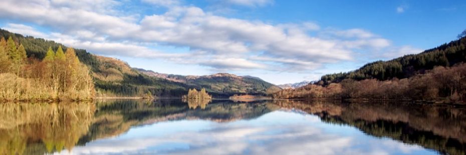
Loch Venachar
Loch Venachar
Loch Venachar lies between the popular tourist town of Callander and the small settlement of Brig o’ Turk. The south shore of the 3.7 mile-long loch comprises a large area of forest, which is home to a wide network of cycling and walking trails. A walk of 4.5 miles reveals a hidden lochan amid the trees.
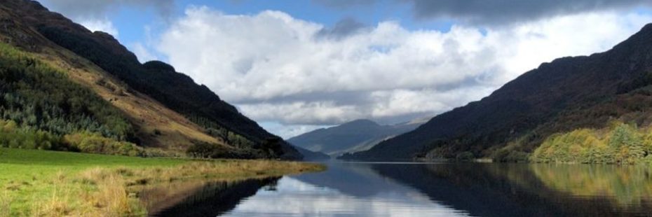
Loch Voil & Loch Doine
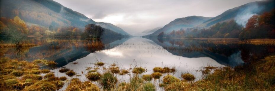
Loch Voil
Loch Voil and its western neighbour, the smaller Loch Doine, lie amid beautiful scenery and in a glen steeped in history. This is part of an area known as Rob Roy country and there are a number of historical highlights relating to the infamous 17th century Scottish outlaw Rob Roy Macgregor. Rob Roy is a Scottish folk hero who became famous through Sir Walter Scott’s novel about his life.
Loch Iubhair & Loch Dochart
Loch Iubhair
Connected by the River Dochart and situated in stunning Glen Dochart lie the two lochs, lubhair (pronounced yoo-ar) and Dochart. They are located on the north side of the A85 when travelling east from Crianlarich.