Breadalbane
Relax in Breadalbane, in the beautiful north east corner of the National Park. Take in the local villages, forest walks and spectacular views. Visit Rob Roy’s grave, travel along a tranquil glen off the beaten track and finish your day at the spectacular Dochart Falls.
You’ll find plenty of spots to stop for a drink or bite to eat and watch the world go by in this stunning part of the Park.
Breadalbane (bred AL-bin) is an area running from the northern part of the Park into Perthshire. Bràghad Albann (brah-ut ALapun) means ‘the upper part of Alba or Scotland’ in Gaelic.
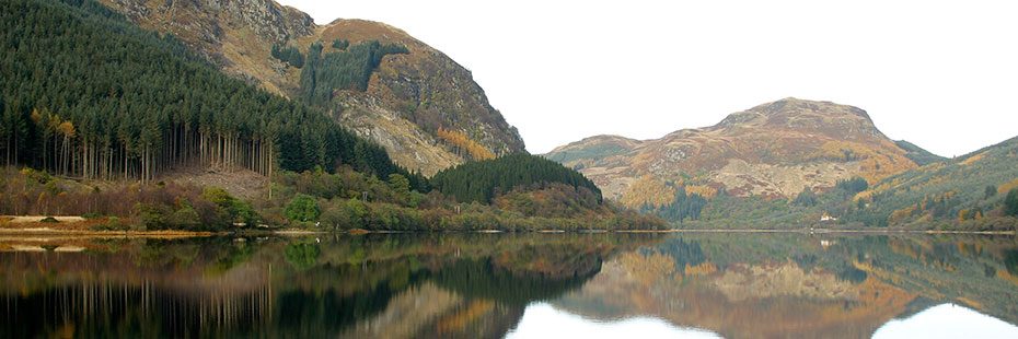
Loch Lubnaig beag
Loch Lubnaig beag
The first stop of your itinerary is ‘Faerie Hollow’. This scenic viewpoint at Loch Lubnaig beag boasts stunning views across Loch Lubnaig to Ben Ledi and lies on the A84, just under 4 miles/6.5km north of Callander. Coming from Callander, the viewpoint is on your left on the banks of Loch Lubnaig – look out sign posts for ‘viewpoint’ and ‘parking’.
If you are approaching from the Crianlarich direction take the A85 to Lochearnhead. In Lochearnhead stay on the main road which becomes the A84 and follow signage for Stirling/Callander. The viewpoint lies 10 miles/16km south of Lochearnhead on your right on the banks of Loch Lubnaig – look out for the ‘viewpoint’ and ‘parking’ signposts.
As you travel along Loch Lubnaig, there are two National Park visitor sites which make the perfect spot to stop and enjoy the scenery – at the site nearer Strathyre you can make use of new barbecue stands, picnic benches and toilets.
Strathyre
Loch Lubnaig
From any of the Loch Lubnaig stops continue north on the A84 (with Loch Lubnaig to your left). Shortly after leaving, you’ll enter the village of Strathyre where you’ll find a car park on the left.
From here take a stroll through the village or embark on the forest walk up through Scots Pine and past waterfalls for fine views across to Ben Vane and the Braes of Balquhidder (1.75 miles/3km; allow 1.5hrs; long steep slope for 400m; narrow earth and grass paths with muddy sections).
Balquhidder & Rob Roy’s Grave
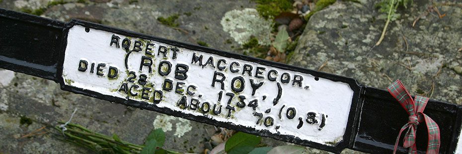
Balquhidder
Turn left on exiting Strathyre car park and follow the road through and out of the village, heading further north on the A84. After just over 2 miles/3km the turn off for Kingshouse/Balquhidder is signposted (alongside brown tourist signage for Rob Roy’s Grave). The turn off for Balquhidder is on your right. Take the underpass and continue to follow the signs for Balquhidder. You’ll reach the village of Balquhidder after 1.8 miles/2.8km.
The church and Rob Roy’s grave lie at the village entrance on your right.
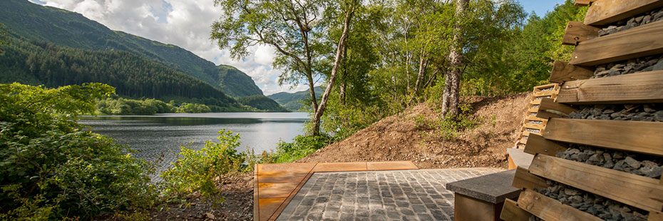
LookOut
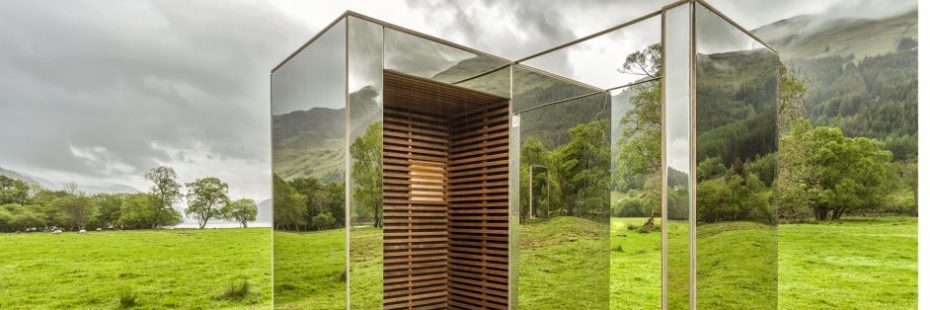
LookOut
If you enjoyed our Loch Lubnaig viewpoint, there is the opportunity to visit another ‘Scenic Route’ installation further down the glen from Balquhidder. ‘LookOut’ is a mirrored cabin, wood-framed pavilion that offers three mesmerizing views of the Loch Voil landscape. It is about 15 minutes drive from Balquhidder, look for the way markers on the roadside near the hotel.
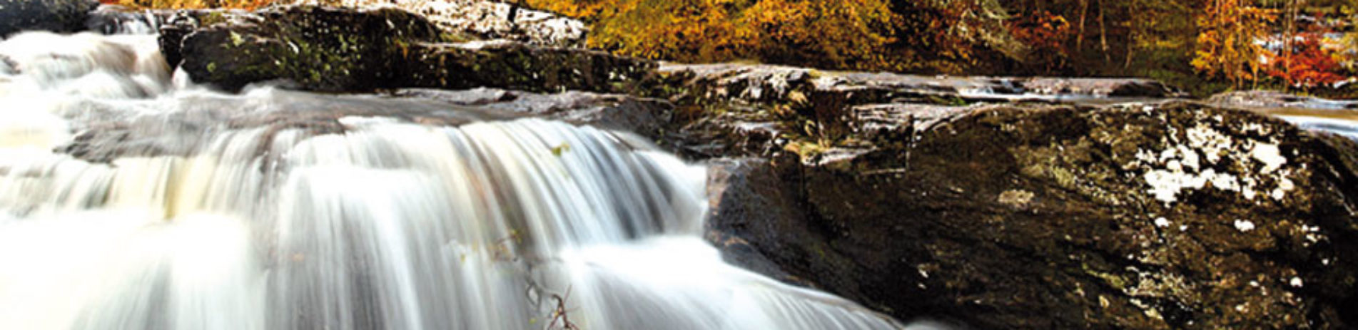
Falls of Dochart, Killin
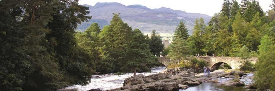
Falls of Dochart
Retrace your route back to the A84 junction and turn right (signposted Crianlarich). After 7.8 miles/12.5km you reach the turn-off for Killin/Falls of Dochart. Turn right onto the A827, follow the road for 2 miles/3.2km and you arrive in the picturesque village of Killin and at the Falls of Dochart.
After you visit retrace your route back to the A85 where you turn right for Crianlarich or left for Callander (signposted Stirling A84).