Loch Eck Loop
There is disruption to this walk please check the Forestry and Land Scotland website for more information.
Grading: moderate / hard.
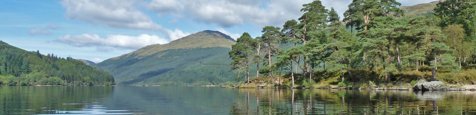
On a clear day, this demanding route reveals magnificent views of Loch Eck, Beinn Mhor and the west coast islands of Jura and Islay. Start / end at Glenbranter on the A815 in the Cowal Peninsula.
At a glance
- Description: either direction (hint: some riders think clockwise is easier!)
- Distance: 33 km / 21 miles
- Ascent: 507m
- Type: mountain bikes – steep slopes in places, occasional loose material on the paths
- Signage: Directional Forestry Commission Scotland
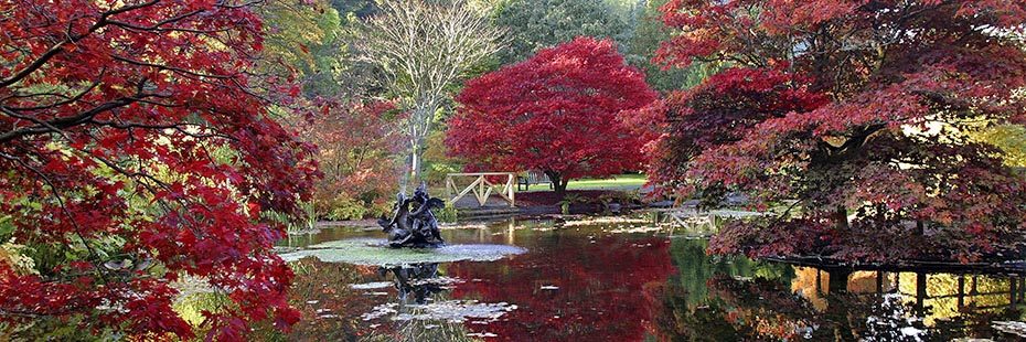
Benmore Botanic Garden
Route description
The loop starts/ends at the Forestry Commission Scotland centre at Glenbranter and is described in a counter clockwise direction. Riders should be aware that although never technical, this is still a demanding ride through remote terrain in the high forests of eastern Loch Eck. Please ensure you (and your bike) are in good condition before setting off.
From Glenbranter (OS Grid Ref. NS 111 977), follow the track south to Glenshellish Farm, head left at the farm and towards the River Cur. The forest track heads along the western shore of Lock Eck for 11km to Benmore Botanical Gardens passing through peaceful forest and many tranquil beaches. Just before entering the gardens (cattle grid), turn left, head downhill to the bridge and cross into the car park /cafe. Cross the A815 (caution) to regain the waymarked path.
Follow the markers up a series of steep (but relatively short) singletrack climbs before rejoining the main forest track to head north. After a sweet section of singletrack around Inverchapel, follow the track for 6.1km, turn right at the Whistlefield Inn marker post and head uphill for 700m and then left to follow a short section of singletrack downhill, cross the unclassified road and head back into the forest. Climb a series of remote forest tracks via Coire Ealt and a rip-roaring descent to rejoin the A815. Turn right and follow the road for a short distance back to Glenbranter.
Points of interest
- Puck’s Glen
- Benmore Botanic Gardens
- Kilmun Arboretum
- Kilmun Mausoleum
- Glenbranter Forest
Facilities
Cafes, Inns, accommodation, toilets and information
Download route card
Details are current as of October 2015. Whilst the Loch Lomond & The Trossachs National Park Authority and its project partners have made every effort to ensure the accuracy of the route card information, Loch Lomond & The Trossachs National Park Authority and its project partners cannot be held responsible in any way for any changes that may take place to the routes, nor for any errors in the route cards, nor for any accidents, injuries or damage sustained whilst following the routes. Cycling is a risk sport and all persons using the cycle routes do so at their own risk, acknowledging and accepting the risk of accident, injury or damage.