Callander Heritage Trail: Stories in the Stones
Grading: easy.
Welcome to Callander, a place where Lowland meets Highland and one of the very first planned towns in Scotland. Beginning in Ancaster Square, you can use this information and the map provided on the bottom of the page to guide you on a circular walk around the core of this fascinating burgh; in some places on the trail, there are also panels that will give you additional information and pictures.
At a glance:
- Grading: easy
- Distance: 1-2 miles
- Path type: pavements and firm-surfaced paths
- Allow ½ to 1 hour
The Trail
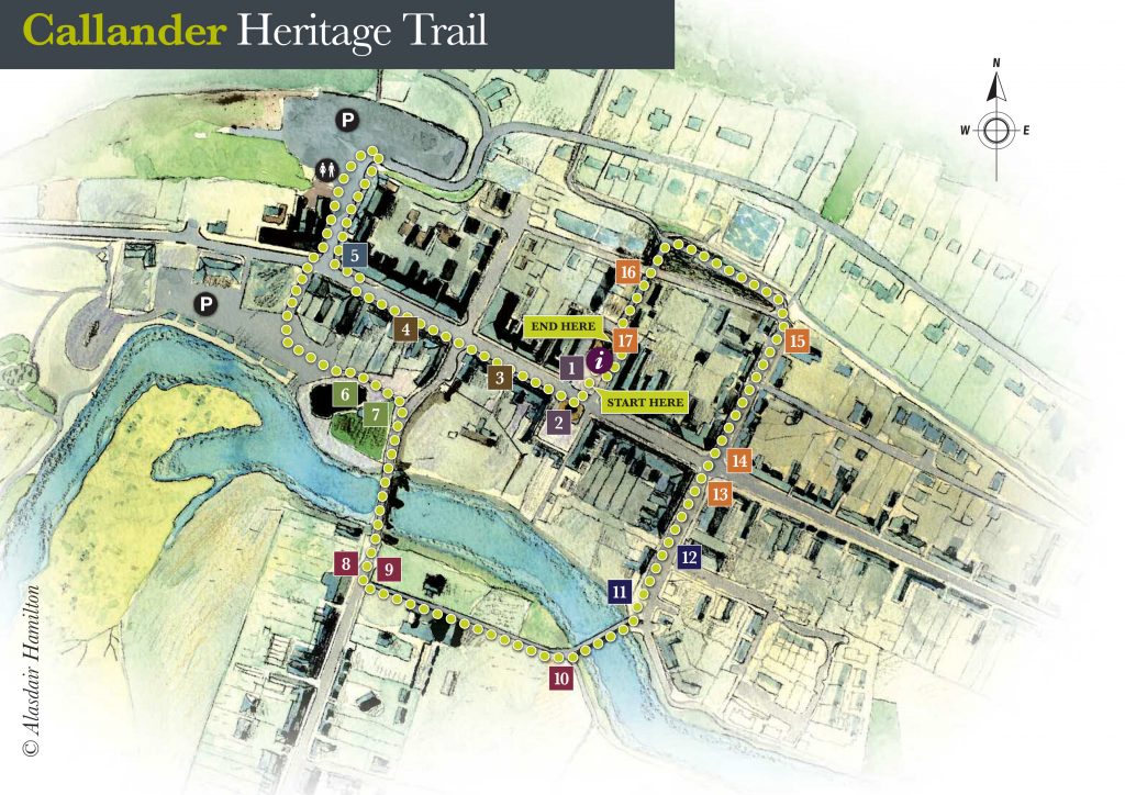
1.
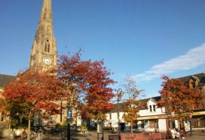
Ancaster Square is the very hub of Callander. In part, that’s because both locals and visitors like to meet, sit for a while, catch buses here or go into the VisitScotland Information Centre. But it’s also because the Square has always been intended to be at the centre of things, ever since town plans were first mapped out, nearly 300 years ago.
The brainchild of James Drummond, 3rd Duke of Perth, drawings made in 1739 are among the very first efforts in Scotland to visualise a carefully planned town. But because the Duke backed the losing Jacobite side in the rebellion of 1745, his lands were confiscated and the plan put on hold until the 1770s. That’s when ‘Commissioners for the Forfeited Estates’ used the Duke’s scheme to create a stone-built town with straight, wide streets, where before there had been only scattered houses.
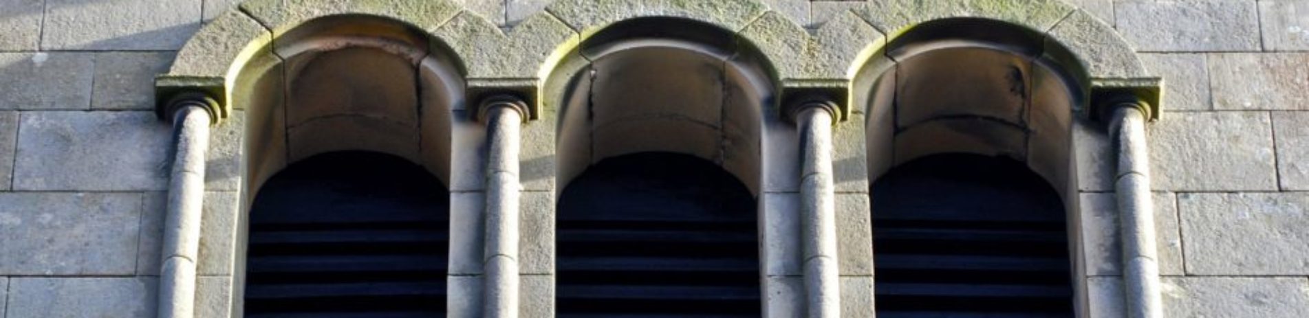
From its earliest years, this square housed a church. The first, designed by John Baxter, Junior, was built in 1773. Baxter was one of the architects of Edinburgh’s New Town and also helped to draw out plans for Rossdhu House beside Loch Lomond. The old Callander Parish Church was replaced in 1883 by the one you see today. Built in the ‘Gothic’ style popular at that time, it includes buttresses that help it to soar to a great height. Later renamed St Kessog’s (after the saint you’ll meet later) it was used for worship until a merger with St Bride’s in 1985, after which it became a Visitor Centre.
Cross Main Street with care to the South Square, directly opposite the church, and you can enjoy the elegant stonework of the old buildings. There’s long been a butcher’s business here.
2.
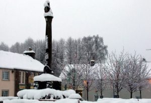
The lion-topped war memorial, built in 1920, was designed by Archibald Kay, a landscape artist who lived at Kilmahog. Often seen around town on his bicycle, he was known as ‘The Captain’ because of his role as leader of the local Boys Brigade.
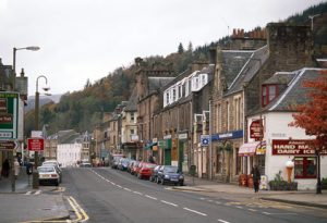
From south Ancaster Square, turn west to go down Main Street, past the local offices of the Loch Lomond & The Trossachs National Park. You’ll notice that the street is very broad. That’s exactly as it was planned, at precisely 60 feet across, in the 1700s.
Between then and the early 1900s, horses, carts, carriages and coaches would have been the typical traffic. So too, at some times of year, would have been hairy Highland cattle. Coming from many parts of the north and west, thousands were moved through here to the great cattle fairs or ‘trysts’ at Doune, Stirling and Falkirk. These markets eventually declined after the coming of the railways in the 1800s. But cattle were still herded down this street well into the 20th century.
 |
 |
| North Ancaster Square | South Ancaster Square (The War Memorial) |
3.
Notice the different styles of buildings you pass. Many of these, such as Lochiel House, just past the National Park office, have an elegance that reflects the wealth of business folk who built them in the 19th century.
4.
Continue down Main Street, cross at the traffic lights and take a look at the wonderfully ornate Old Bank. Now a restaurant, in the past this has also been a bank under three different names and twice a hotel. It was built in 1883 for the Commercial Bank of Scotland and was possibly the last project of architect David Rhind, who died in the year it was constructed. In a career spanning more than 50 years, he designed more than 80 bank buildings, from Shetland to Stranraer.
5.
Continue on to the corner and look out for the pavement marker at the corner of Station Road, opposite the Dreadnought Hotel. Turreted and large, the Dreadnought Hotel at the western end of Main Street is a striking building. It’s notable not only for its size, but because of its role in local tourism for over two centuries.
Much expanded in later years, the original Dreadnought was built in 1802 by the chief of the Clan MacNab. It replaced Callander‘s original inn and was likely to have been where the famous ‘Romantic’ writers, William and Dorothy Wordsworth, stayed during their tour of Scotland in the autumn of 1803. Later, When Sir Walter Scott set his bestselling epic poem ‘The Lady of the Lake’ in the Trossachs, visitors began to come to Callander by the thousands, using it as a base for tours.
The Dreadnought always played a central part in that tourism, at first through trips in horse-drawn carriages and coaches. This business expanded with the arrival of the railway in 1858. When Callander station moved, later that century, to where the large car park now sits between the Dreadnought and the ‘Crags’ above the town, the hotel was in an ideal position to offer transport, lodging and meals to travellers. Around that time, a small group could hire a one-horse carriage and driver to take them on a return trip to the Trossachs for 11 shillings and 6 pence (less than 60p). Or you could stay at the Hotel for a week for just over £3.
The Dreadnought was also once a popular hotel with railway travellers. To find out more about Callander’s railway heritage, go up Station Road to the large car park. Interpretation boards there will reveal more. Public toilets are to the left of the car park’s Station Road entrance. If you would rather continue on the trail, cross the road into the Meadows Car Park.
6.
Two features are likely to draw your eye now. One is the river – the Teith – lapping at the fringe and often hosting a range of ducks, swans and gulls. But furthermore, there’s the large, smooth-sided and flat-topped mound to the left. That’s Tom na Chisaig (loosely based on the Gaelic for ‘Kessog’s Hill’), named after one of Scotland’s most important early Celtic saints. Irish by birth, Kessog came as a missionary to the lands of Lennox (south of Callander) early in the 6th century and may have preached near this spot. He was based at Inchtavannach (‘Monk’s Island’) on Loch Lomond, close to Luss, and was martyred in a bay near there. Kessog was held in such importance in medieval Scotland that it is said that Robert the Bruce invoked his name before leading his troops into battle at Bannockburn.
But the artificial hill that bears his name was built much later, possibly as a ‘motte’ or castle hill in the 12th century. The old Callander Parish Church (removed when the first church was built in Ancaster Square in 1773) also stood just beyond it, where the old kirkyard now lies. The mound of Tom na Chisaig was used long ago as a place where archers could practise. It was later used for outdoor services while the Free Church in South Church Street was being built.
 |
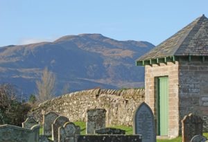 |
| The graveyard | The octagonal watch house (with Ben Ledi in the distance) |
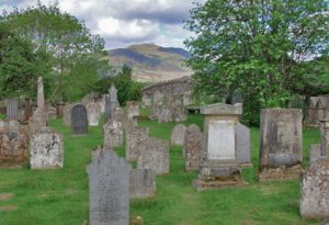
7.
Follow the short path east from the mound to Bridge Street, then turn right and look over the wall into the graveyard – many of the graves date from the late 1700s and early 1800s. The octagonal watch house was built as a lookout to guard the kirkyard from ‘body snatchers’. Until 1832, when the legal supply of bodies that anatomists could study was increased, a shortage of such corpses meant that criminals could make money through robbing fresh graves.
Follow the pavement by the graveyard to use the Red Bridge to cross the River Teith. Named for the colour of its sandstone, this bridge dates from 1908 and replaces an earlier stone bridge built in 1764. In the 1960s, it was seen every week by millions of viewers through being shown in the opening titles of the early hit TV series ‘Dr Finlay’s Casebook’, which was filmed in Callander.
This section has long been a good place to cross the river. A ferry once operated near here and cattle drovers are said to have moved their herds across using a ford not far downstream. The part of Callander over the bridge is called Bridgend and has an interesting variety of buildings, from small cottages to grand, classical-style ones.
8.
The black-and-white frontage to the Bridgend Hotel is a 19th century addition to a much earlier building. Stroll down the street if you like, or come back later to explore.
9.
The main trail continues across the street from the Bridgend Hotel, going along the path at the riverward side of the school. Now a primary school, this elegant building was once the McLaren High School. It was designed by John Stewart and George Paterson in 1907, the year they designed Perth City Hall. The same architects also helped to re-model Roman Camp House (now a hotel) and built houses in Esher Crescent for veterans from the First World War.
10.
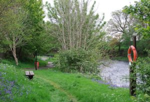
Continue to the footbridge and pause to let the scene soak in. “The Teith is the sweetest voiced of all Scottish streams,” wrote the poet, Alexander Smith. Its clean, clear waters support a very healthy range of wildlife, which includes the salmon and sea trout that are popular with anglers. But the Teith is also unusual in hosting three different species of lamprey – a primitive, eel-like fish. The lampreys alone are enough to give it European importance for nature conservation. Also, in the past, freshwater pearl mussels were harvested from the Teith and gave an income for some families in what has since been re-named Pearl Street, across the footbridge on the town side. Native freshwater mussels are now rare in Scotland and most harvesting in Callander had stopped by the late 1800s.
11.
Go past the sundial where an interpretation panel can give you more information, and continue up the street. There’s a distinct look of the sunny south about St Bride’s – now Callander Kirk. That might seem surprising, given its origins. It was built in the 1840s as a base for members of the newly formed Free Church, following a nationwide split – ‘The Disruption’ – from the Church of Scotland. Then, as now, Free Church folk had a no-frills approach to worship.
The original building was simple, constructed in large measure by volunteers. The southern look came in 1861, when Glasgow architect, George Penrose Kennedy, made large additions. These include the distinctive belvedere (fair view) bell tower, which wouldn’t seem out of place in Rome or Tuscany. The Italian look reflects a fashionable style in mid- Victorian architecture.
 |
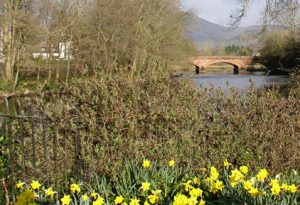 |
| River Teith walkway | River Teith with the Red Bridge in the distance |
12.
George Kennedy also designed the Kirk Hall building, next door to the church. It was built in 1849, using money from successful local businessman and banker Donald McLaren, and was the Free Church School for nearly 50 years. Its purpose was to promote the religious and moral training of the young in the Parish and neighbourhood of Callander. Now it functions as the hall for Callander Kirk and community.
The bell of the old parish church in Ancaster Square now sits in the garden at the north-east side of the Kirk Hall. It was once said that its chime could be heard up to 12 miles away.
13.
Continue to the corner of Main Street and pause to notice the variety of traditional buildings of varying heights, design and age which give Callander an interesting streetscape.
14.
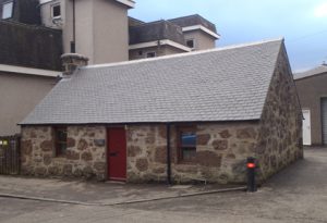
Cross to North Church Street (directly opposite). There’s some excellent use of puddingstone in buildings of different ages here, including the single storey Sorisdale Cottage (oldest house in Callander) near the top of the street.
15.
You can continue straight up the hill to longer walks on the Crags and to Bracklinn Falls (please note that Bracklinn Bridge is currently closed, check for further information and updates before visiting this site) or to finish the Town Heritage Trail, turn left along the small path that goes westward parallel to the track of the old railway line.
The coming of the railway to Callander in 1858 marked a huge change for both the town and its people. Before that, one coach a day had been the only connection to Stirling along a notoriously bad road. Now several trains a day made that journey at much greater speed. That allowed locals to travel more readily and made Callander accessible to many more visitors.
Some 75,000 people travelled the line in its first four years. A new type of visitor – known locally as the ‘carriage-folk’ – began to appear. Often from wealthy city families, these people rented local houses for the summer, both in the centre of town (where locals would move out to make money from summer lets) and in villas at Leny Feus.
Railway companies changed and lines were extended west to Oban during the 19th century. The first station was at the east end of town and became a halt/goods yard when the Callander and Oban Railway built a new station behind the Dreadnought Hotel.
 |
 |
| Sorisdale Cottage | The Main Street |
16.
Turn left through the massive stone portal formed by the supports of what was once a railway bridge. Go past two cast-iron uprights, once used as station turnstiles. An information board with suggestions of other routes to use to explore Callander and its surrounds marks the end of this heritage trail.
17.
From here, at the rear of St Kessog’s, a few more steps will take you back to Ancaster Square.
Download map
This information was created in partnership with Callander Community Development Trust, Callander & District Heritage Society, Stirling Council, Loch Lomond & The Trossachs National Park and Historic Environment Scotland
Archive photographs: Callander & District Heritage Society
Other photographs: Kenny Taylor, Laurie Campbell, Sheila Winstone, Kirsty Callaghan, Ewan Myles, Gavin Young
Text: Kenny Taylor, Natural Media
Map illustration: Alasdair Hamilton, Ordie Interpretative Design
Other illustrations: John Tasker