Arrochar
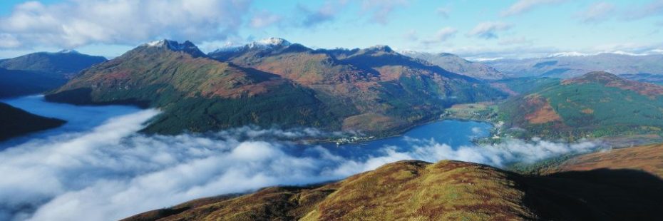
Arrochar is a rural settlement located at the head of Loch Long and nestled amongst the high mountains of the Arrochar Alps. The village is popular with mountaineers due to its excellent road and rail links and close proximity to the Arrochar Alps.
It is one of the main access points to Argyll Forest Park, which stretches from the western shores of Loch Lomond south as far as Holy Loch. The village is set amongst some of the most beautiful scenery on the Cowal Peninsula and is a convenient base for exploring the northern section of the Forest Park.
The Scottish Gaelic of Arrochar is An t–Àrchar or An Tairbeart Iar.

View of Loch Long and Arrochar village with the Arrochar Alps in the background
A target for Viking raiders
The area is steeped in history, being ruled first by the barons of Arrochar and later by the chiefs of the MacFarlane Clan. In later years the MacFarlanes were known as cattle rustlers and they would steal their neighbours’ livestock by moonlight. This became such a frequent occurrence that the full moon became known as “MacFarlane’s lantern”!
Arrochar was a key target for Viking raiders who dragged their boats 2 miles overland to Tarbet to attack the unprotected inland settlements of Loch Lomond before their defeat in 1263 at the battle of Largs.
Munros and forest walks
Argyll Forest Park includes the Arrochar Alps, north of Glen Croe and Glen Kinglas, whose Munros (mounatins over 3000ft/914m) and Corbetts (mountains between 2,500 and 3,000 feet /762.0 and 914.4 m) offer some of the best climbing in Argyll. Ben Ime (3,318ft) is the tallest of the range, while Ben Arthur (also known as ‘The Cobbler’, 2,891ft) is easily the most distinctive. All are for experienced walkers only. There are also several easier forest walks throughout the Forest Park clearly laid out by the Forestry Commission.
In the hills around Arrochar, you may be lucky enough to spot a golden eagle soaring high over the mountain tops and red deer on the hillsides.
Did you know?
- The name Arrochar probably came from the Gaelic word arachor, an ancient Scottish measurement of land equal to 104 acres and defined as the area of land eight oxen could plough in a year.
- Arrochar was significant in the development of Scottish climbing, thanks to the ‘Cobbler Club’ in the late 1800s, probably the earliest mountaineering club in the region.
Find out more…
- Find out more about the local Arrochar community and the work they do.
- Friends of Loch Lomond’s offers further information on the natural and cultural heritage of the area.
- Access the Community Action Plan to find information on what it is like to live in Arrochar, Tarbet & Ardlui now, the aspirations and priorities for the future of the local community and how they will be achieved.
- Visit our camping pages on Loch Long and the surrounding area.

