Poor quality of lochs and rivers
There are 92 river and loch water bodies that fall completely or partially within the Loch Lomond & The Trossachs National Park and the five coastal water bodies which partially border the National Park.
Freshwater
The major river systems in the National Park are the Tay, Forth, Teith and Lomond catchment. There are also many small burns and rivers draining directly into the coast and narrow sea lochs on our western edge. They all provide a wide variety of wildlife habitats both in-stream and marginal, and can act as important wildlife corridors. As well as providing an important biological resource, they influence the characteristics of the surrounding landscape, supply water for domestic, agricultural and industrial use and provide opportunities for recreation.
Their ability to function as a vital part of National Park ecosystems is affected by many different pressures, such as pollution from surrounding land uses including agriculture and forestry operations (felling and roading), bank erosion control measures, flood defences and alterations to improve drainage so their ability to adapt to changing conditions is often much reduced. The restoration and enhancement of degraded waterbodies and peatlands, in order to aid their water and carbon storage natural functions, is highly important, as is their role as major sources of drinking water and hydro-electricity generation.
The Scottish Environment Protection Agency (SEPA) produces an annual Water Framework Directive (WFD) Classification for all the water bodies in Scotland. Currently 44% of waterbodies within the National Park have been given the status of either high or good overall condition by SEPA which is below the national average of 62%.
There are healthy populations of species such as Atlantic salmon, river lamprey and otter. A number of physical barriers such as weirs are present in the Teith and Loch Lomond catchments, which are currently preventing or delaying migration of species such as Atlantic salmon and river lamprey to their spawning habitats. There are fragmented populations of water vole present in the National Park; however the Trossachs Water Vole Project, which has had notable successes over the last 10 years following re-introductions, has seen the species spread its range.
Stretches of several rivers within the National Park are designated or lie within designated sites, such as the River Tay SAC, River Teith SAC, Endrick Water SAC and Loch Eck SSSI.
Objectives by 2023
- Improve water quality by reducing point source and diffuse pollution.
- Improve habitat quality, particularly focussing on riparian habitats to provide natural flood management, improve ecology and climate change benefits.
- Explore opportunities to demonstrate benefits of natural flood management in Strathard.
- Enable fish to access rivers by adapting artificial barriers.
- Improve quality of water environment by carrying out river bank protection, restoration, re-connecting and re-watering back channels on targeted rivers.
- Monitor current health of riparian and aquatic species populations.
- Deliver education in schools and communities to highlight aquatic biodiversity and water quality.
- Plant riparian woodland to enhance aquatic ecosystems, cooling, strengthen woodland habitat networks, and help manage flooding.
- Raise awareness to the health and recreation benefits of improved water quality.
Overall Condition – includes five categories and is based on measurements of chemistry, hydrology (changes to water levels and water flows) morphology (changes to the beds, banks and shores of water bodies) and assessment of invasive non-native species (INNS).
Marine
The Cowal area of the National Park includes 39 miles of coastline around three sea lochs: Loch Long, Loch Goil and the Holy Loch. Upper Loch Fyne and Loch Goil, some of which is in the National Park, are Marine Protected Areas.

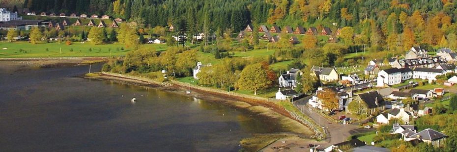
Lochgoilhead
This marine environment within the National Park includes the intertidal zone and is extremely rich in biodiversity. The National Park coastline has a range of habitats including rocky shores, cliffs, small areas of salt marsh and mudflats rich in marine invertebrates, which in turn support a range of wading birds and also provide great opportunities for people who live and visit the area to enjoy the wildlife found along the seashore and in marine waters.
Objectives by 2023
- To raise awareness of marine litter and pollution affecting the National Park’s coastal environment and communities.
- To produce and begin implantation of a strategic plan that addresses how to tackle the problems with marine litter and pollution in the Sea Lochs of the National Park.

