Waterfalls
Gaelic has several words for a waterfall, the most common being eas (ESS). Waterfalls and fast running water were given special status in Gaelic tradition, often being the haunts of supernatural creatures, although evil spirits were said not to be able to cross running water.
There are many fine waterfalls in the Park; the following are some of the best known.
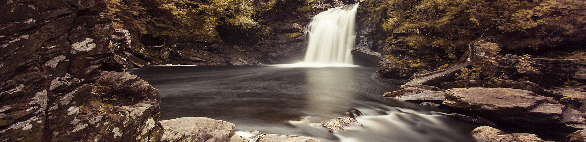
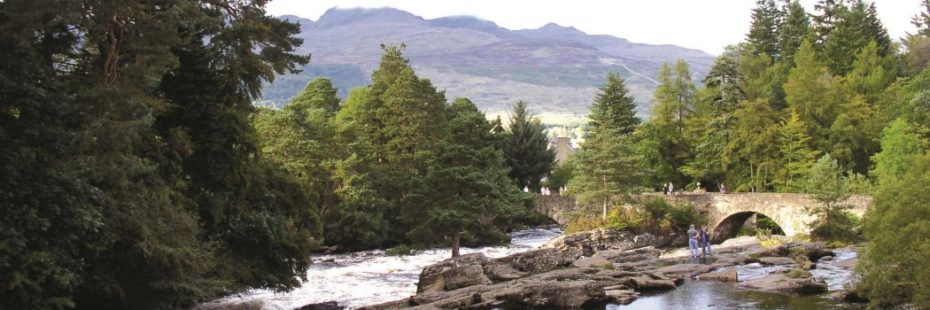
Inversnaid
Gaelic: Eas Inbhir Snàthaid (inivur SNAA-itch), meaning ‘The mouth of Allt na Snàthaid’ (the needle-like stream)
Inversnaid Falls (credit: John McSporran)
Easy access, very short distance south of the Hotel. Path leads down to a bridge over a peaceful pool with waterfall cascading over The Arklet Burn, as it falls into Loch Lomond . Gerald Manley Hopkins (1844–1889), whose posthumous 20th century fame established him among the leading Victorian poets, wrote of the falls in his poem ‘Inversnaid’:“What would the world be, once bereft Of wet and of wildness? Let them be left, O let them be left, wildness and wet; Long live the weeds and the wilderness yet.”
How to get there
- By public transport – Tarbet is easily accessible from Glasgow and central Scotland by coach, as Citylink operates several daily journeys that take 1hr10min. Alternatively, take a train to the Arrochar & Tarbet station (on the Highland line, accessible from Glasgow, and taking approx. 1hr30min). From Tarbet you can take a waterbus to Inversnaid – click here for a map and timetable.
- By car – From Glasgow, take the A81 from the city centre via Milngavie and Strathblane and follow the signposts for Aberfoyle. From Edinburgh and Perth, travel towards Stirling on the M9 and leave at Junction 10 (marked for Stirling). Follow the A84, signposted for Callander, and after 4 miles (just beyond the Safari Park), take the A873 for Aberfoyle. From Aberfoyle, take the B829 road, passing first Loch Ard, then Loch Chon, before finally reaching Inversnaid.
Falls of Falloch
Gaelic: Eas Falach (FALuch), meaning from the [Falloch] glen
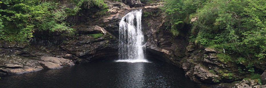
Falls of Falloch
A nice spot for a picnic, just a short walk away from the A82 so it can be incorporated as a break in a journey. An impressive piece of river for expert canoeists and also a host for an art installation, ‘Woven Sound‘, which is a Scottish Scenic Routes project created in 2013 to enhance the visitor experience of the Scottish landscape, among others.
How to get there
- By public transport – No public transport available.
- By car – From Glasgow, follow the A82 north for 52 miles, by way of Loch Lomond; shortly after you pass Inverarnan you will see signposts for the waterfall on the right.
Please note that construction work will be taking place at the Falls of Falloch in spring 2026. The site will close temporarily week commencing 30 March 2026, with no public access during this time, and we aim to reopen to visitors in July 2026.
This work will help the area cope with increasing visitor pressure, reduce safety risks and damage to woodland and riverside habitat, and help deliver our ambitions for high-quality visitor infrastructure, responsible access, and a low-carbon future. Find out more about the Falls of Falloch closure.
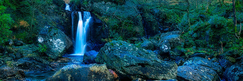
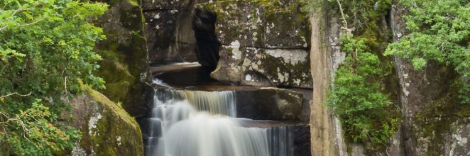
Puck’s Glen
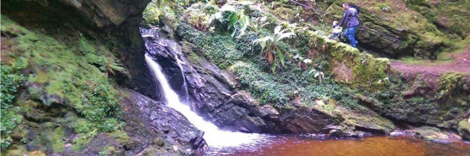
Waterfall in Puck's Glen
Puck’s Glen is one of the many gems of the Cowal peninsula and offers an unforgettable experience through the dark and mossy woods of the Argyll Forest Park. The short circuit, less than 2 hours, takes you up by the descending stream, where you will dozens of waterfalls, and then down through the mixed forest, where you will have spectacular viewpoints of the area and of the many rhododendrons.
How to get there
- By public transport – Get the train to Gourock station, which is a 3-minute walk to the ferry terminal, where Argyll Ferries sail from Gourock to Dunoon. When you arrive in Dunoon, Castle Gardens bus stop is around a 2-minute walk from the ferry terminal. Here take the 489 service (West Coast Motors) bus to Benmore Botanic Gardens. For more details visit the Traveline Scotland website.
- By car & ferry – Travel to McInroy’s Point just west of Gourock and take the car ferry with Western Ferries to Hunters Quay. Take the A815 westwards following signs for the Botanic Gardens (you will see a sign for Puck’s Glen 1 mile before you reach Benmore). Or take the A82 north to Loch Lomond. Turn onto the A83 at Tarbet and change to the A815 at Strachur. After passing Loch Eck on your right follow signs for the Botanic Gardens, Puck’s Glen being 1 mile down the road after that.
Explore Puck’s Glen with Google Street View
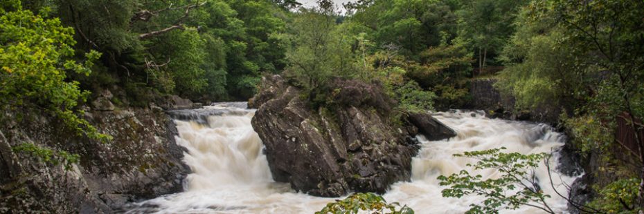
Falls of Dochart
Gaelic: Eas Dochart (DOCHart). Reputedly ‘the scourer’ (with negative connotations, referring to this impressive feature in Killin).
Falls of Dochart in Killin
Very easy access. Be careful of traffic if viewing from the bridge. When water level is lower it’s very easy to scramble out onto dry ledges and boulders, but take care as they may be slippery. The River Dochart widens just before Killin and at same time the gradient steepens resulting in the Falls. Passing under the bridge water cascades down over the rocks and around the island of Inchbuie, which is the traditional burial place of the McNab Clan.
How to get there
- By public transport – There are more national bus services within the region in summer than in winter. Summer services run from the beginning of the 4th week of May to the end of the 1st week of October. Summer services passing through Killin include Citylink 913 from Edinburgh to Fort William, Citylink 973 from Dundee to Oban and Citylink 978 from Edinburgh to Oban. There is also a local bus service, Kingshouse Travel C60, running from Callander to Killin. For more details click here to access the Traveline Scotland website.
- By car – From Glasgow, there are two routes to get to Killin. Follow the A82 north for 56 miles, by way of Loch Lomond, to Crianlarich, then switch to the A85 in the direction of Killin. However, a slightly shorter (and equally scenic) way is by following the M80 out of Glasgow and switching to the A84 at Stirling, then following signs for Callander and eventually Killin.
From Edinburgh, take the M9 route to Stirling and switch there to the A84, then following signs for Callander and eventually Killin. - By bike – The National Cycle Network Route 7 (NCN 7) runs through the heart of the National Park, and takes in classic Trossachs scenery en route. This route passes right through Killin. Find out more here.
Bracklinn Falls
Gaelic: A’ Bhreac Linn (uh VREH-uchk leen), meaning ‘Dappled pool’.
Bracklinn Falls
Bracklinn Falls were a popular attraction in Victorian time. Walk from Callander or avoid some of the steepness by driving to the Falls car park.
Exploring more remote areas of the National Park is a great way to immerse yourself in nature, but it is important to be prepared. Some locations may not have a mobile phone signal and can be difficult for emergency services to reach.
When visiting, tell someone where you are going and when you expect to return, and when there, acknowledge any warnings of danger – like steep drops or deep water, and keep children close by.
How to get there
- By public transport – The best way to get to Callander is to hop on a bus from Stirling. For bus times click here.
- By bike – The National Cycle Network Route 7 (NCN 7) runs through the heart of the National Park, and takes in classic Trossachs scenery en route. This route passes right through Callander. Find out more here.
- By car – From Glasgow it takes only approximately 1 hour to get here (41 miles) via Stirling, by taking the M80 and then A84. From Edinburgh it takes approximately 1 hour 20 minutes to get here (51 miles) via Stirling, by taking the M9 and then A84.
Please be aware that the route currently displayed by Google Maps to get to Bracklinn Falls by car is incorrect. The correct route is turning off Callander Main Street onto Bracklinn Rd and onwards to Bracklinn Falls Car Park, from where you will have to walk a further 1km/0.6 miles. We have contacted Google to get the map updated.
Beinglas Falls
Gaelic: A’ Bheinn Ghlas. The name derives from the adjacent mountain Ben Glas, properly A’ Bheinn Ghlas (uh vayn GHLAS) ‘the green mountain’. In Gaelic, the feature is Eas na Beinne Glaise (nuh baynyuh GLASHuh).
Beinglas Falls from the Drovers Inn (A82)
The falls are impressively high (1000ft/300m) and can clearly be seen from the A82 and the Drover’s Inn, a few hundred metres away. In order to access them, you need to cross the Beinglass Campsite and ascend for approx. 30 min. on the same path that eventually leads to Beinn Chabhair, one of the 21 Munros in the Park. The path is steep and quite a challenge in itself, but once you hear the roar of the water before they come into view, you will know it was all worth it.
How to get there
- By public transport – The easiest way up this Munro is from Inverarnan, by the Drovers Inn – there is no designated bus stop here, but drivers are usually willing to drop you off. However, it will be trickier upon your return as you need to reach either Crianlarich or Ardlui for the bus/train, which are each a few miles away. The other alternative is to follow the route up An Caisteal until a certain point, starting from Crianlarich, which is easily accessible from Glasgow and central Scotland by coach, as Citylink operates several frequent journeys that take approximately 1hr45min. Alternatively, take a train on the Highland line, accessible from Glasgow, and taking approximately 2 hours. You have to walk approximately 1.5 miles on the A82 in the direction of Loch Lomond/Glasgow, after which you will see River Falloch on your left – from the layby close-by climb the stile and cross the boggy field to the underpass under the railway. Follow the track as it crosses the River Falloch on a bridge and continue on the track heading gently uphill.
- By car – From Glasgow, follow the A82 north for 52 miles, by way of Loch Lomond, until Inverarnan.
Falls of Leny
Gaelic: Eas Lànaigh (LAANee). Meaning obscure. The Pass of Leny is Cumhang Lànaigh (koo-unk LAANee). The river is the well-named Garbh Uisge (garav OOSHkuh) ‘boisterous river’.
Falls of Leny (credit: Tim Messer)
The best view of the Falls is from the National Cycle Route 7, a good walk from Callander or a shorter walk from Ben Ledi car park (which is very popular, so make sure you get there early). You can also access them from the car park at Kilmahog (which has a link path to the National Cycle Route 7). It is popular with (competent and experienced) canoeists and very spectacular, especially after heavy rain.
How to get there
- By public transport – There is none, but you can walk approximately 4km from Callander to reach the Falls.
- By car – The Falls of Leny car park is on the A84, approximately 4km west of Callander.