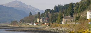
Holy Loch
Located to the south-western edge of the National Park is the Holy Loch. The National Park edges the northern shore of the sea loch, which measures one mile wide by up to three miles long, depending on the tide.
The Holy Loch forms part of the Cowal Peninsula coast of the Firth of Clyde and its name is believed to date from the sixth century, when Saint Munn landed there after leaving Ireland. Kilmun Parish Church and Argyll Mausoleum are said to stand where Saint Munn’s church was once located.
Other historical references include World War II, during which time the loch was used as a British Royal Navy submarine base.
Holy Loch is known to sailors as the “marine gateway to Loch Lomond & the Trossachs National Park”. Many boats and yachts are seen in the port, while kayakers enjoy paddling on the tidal waters.
Spreading north form the Holy Loch is the Ardentinny Peninsula, which is home to beaches and woodland, part of the Argyll Forest Park. A walk of almost five miles takes you to the small summit of Strone Hill or stroll various forest trails, such as the Conifer Trail or John Jackson Trail, at Kilmun arboretum.
Make a stay of it
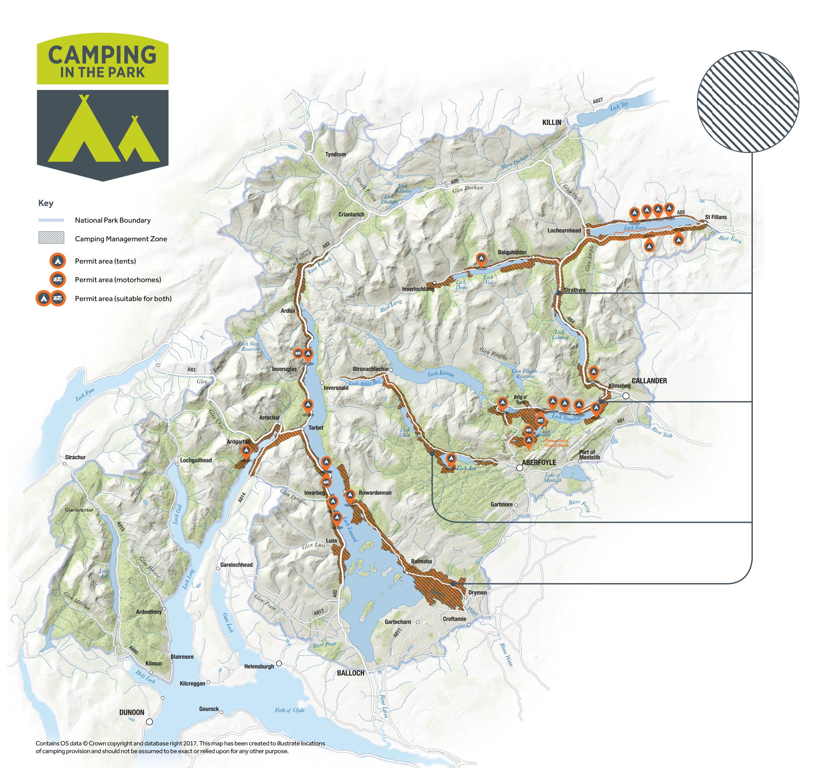
Whether you’re looking for the comfort of a campsite or the solitude of ‘wild camping’, the National Park offers plenty of places to immerse yourself in some of the most spectacular scenery in Scotland.
If you are planning to ‘wild camp’, be aware that seasonal byelaws came into effect on 1st March 2017 which affect how you can camp in some areas between March and September. During this time, you need a permit to camp or (in some locations) to stay overnight in your motorhome in these Camping Management Zones.
Explore our map to find your perfect spot